Galápagos map: San Cristóbal routes
Galápagos map: San Cristóbal routes [2026]
A useful Galápagos map separates places from services. This one shows town bases, an airport gateway and selected visitor sites, with planning connections rather than promised daily routes. Start with your arrival island and work outward.
Compare tours: San Cristóbal tours compared [2026] →
Updated
The short answer
The map is for trip orientation. Lines are not live schedules, navigation tracks or permission for independent entry.
GALÁPAGOS
A map for planning the journey
Select a stop to see its role in the trip. Lines show planning connections, not live services, road directions or guaranteed transfers. Confirm departures and access with your operator.
Number labels are offset where needed; fine lines connect them to the actual point.
Baltra / Seymour airport
Airport reference point from DGAC. Reaching Puerto Ayora adds channel and land transfers.
-0.4539°, -90.2658° · Open geographical map ↗
Puerto Ayora · Santa Cruz
Approximate town/port anchor. Confirm the actual departure pier and reporting point.
-0.7485°, -90.3048° · Open geographical map ↗
Puerto Baquerizo Moreno · San Cristóbal
Approximate town base, not an exact meeting point.
-0.9000°, -89.6100° · Open geographical map ↗
Puerto Villamil · Isabela
Approximate town base for accommodation and local excursions.
-0.9600°, -90.9700° · Open geographical map ↗
Kicker Rock / León Dormido
DPNG visitor-site reference; authorized excursion required. Not a navigation waypoint.
-0.7757°, -89.5180° · Open geographical map ↗
Isla Lobos
Guided visitor site with land and marine components determined by the actual itinerary.
-0.8551°, -89.5645° · Open geographical map ↗
Punta Pitt
A boat viewpoint on a 360 circuit does not establish a permitted landing or hike.
-0.7131°, -89.2466° · Open geographical map ↗
Cerro Tijeretas
DPNG reference position, not turn-by-turn trail guidance. Check current access.
-0.8893°, -89.6081° · Open geographical map ↗
Interpretation Centre
Municipal visitor-directory site; confirm current visiting arrangements.
-0.8940°, -89.6095° · Open geographical map ↗
Punta Carola
Coastal reference. Beach appearance does not determine swimming suitability or access.
-0.8900°, -89.6125° · Open geographical map ↗
La Lobería
Municipal visitor-directory site; follow current ranger and water-condition instructions.
-0.9265°, -89.6124° · Open geographical map ↗
Cerro Brujo
Check whether your circuit promises a boat view, water session or permitted beach landing.
-0.7644°, -89.4589° · Open geographical map ↗
Puerto Chino
DPNG reference for highland-side route planning; confirm transport and site access.
-0.9257°, -89.4298° · Open geographical map ↗
- Baltra / Seymour airport → Puerto Ayora · Santa Cruz · Guided excursion: Planning connection: arrange the land and channel stages; no timetable or fare implied.
- Puerto Ayora · Santa Cruz → Puerto Baquerizo Moreno · San Cristóbal · Guided excursion: Confirm the date’s actual boat. DPNG gives an approximate 2–3-hour crossing scale, conditions dependent.
- Puerto Ayora · Santa Cruz → Puerto Villamil · Isabela · Guided excursion: Confirm the sailing and all boarding charges; the line does not guarantee a daily service.
- Puerto Baquerizo Moreno · San Cristóbal → Kicker Rock / León Dormido · Guided excursion: Planning link only: verify the exact authorized itinerary and whether a landing is included.
- Puerto Baquerizo Moreno · San Cristóbal → Isla Lobos · Guided excursion: Planning link only: verify the exact authorized itinerary and whether a landing is included.
- Puerto Baquerizo Moreno · San Cristóbal → Punta Pitt · Guided excursion: Planning link only: verify the exact authorized itinerary and whether a landing is included.
- Puerto Baquerizo Moreno · San Cristóbal → Cerro Brujo · Guided excursion: Planning link only: verify the exact authorized itinerary and whether a landing is included.
- Puerto Baquerizo Moreno · San Cristóbal → Cerro Tijeretas · Guided excursion: Check the actual permitted route, transport and any guide or reservation requirement.
- Puerto Baquerizo Moreno · San Cristóbal → Interpretation Centre · Guided excursion: Check the actual permitted route, transport and any guide or reservation requirement.
- Puerto Baquerizo Moreno · San Cristóbal → Punta Carola · Guided excursion: Check the actual permitted route, transport and any guide or reservation requirement.
- Puerto Baquerizo Moreno · San Cristóbal → La Lobería · Guided excursion: Check the actual permitted route, transport and any guide or reservation requirement.
- Puerto Baquerizo Moreno · San Cristóbal → Puerto Chino · Guided excursion: Check the actual permitted route, transport and any guide or reservation requirement.
Select a stop to see its role in the trip. Lines show planning connections, not live services, road directions or guaranteed transfers. Confirm departures and access with your operator. · Natural Earth
Use towns as the first anchors
Puerto Baquerizo Moreno is the San Cristóbal base, Puerto Ayora belongs to Santa Cruz and Puerto Villamil is on Isabela. A product can appear under “Galápagos” while starting on any of these islands. Check the meeting-point town before interpreting the attraction photo as something near your room.
Baltra/Seymour is an airport gateway north of Santa Cruz, not a waterfront neighbourhood of Puerto Ayora. Its marker explains the extra transfer stages before a ferry.
Group San Cristóbal visits by the journey
Kicker Rock and Isla Lobos are organized boat outings. The Interpretation Centre and Tijeretas are part of the near-town land plan, while Punta Pitt requires checking the specific permitted visit. A 360 circuit may name it without a land walk.
Do not join every marker into one day. Choose a marine outing, a land route and transport windows separately.
What the source coordinates mean
Visitor-site positions come from DPNG’s management-plan coordinate table, rounded for orientation; town positions are approximate anchors. Airport orientation is cross-checked with DGAC’s Seymour information. These are reference points, not trail entrances, road instructions or landing coordinates for a private boat.
Access and permitted activities come from current park instructions, not from the age of a map marker. Ask the guide or authority about the route operating on your date.
Turn the map into a booking sequence
Fix arrival airport and first accommodation, then confirm inter-island legs. Add a full local day for your priority excursion. Only afterward decide whether another island adds enough to justify the crossing and a further room change.
The map complements the ferry and arrival guides. Its direct connections describe how to think about the trip; they do not confirm a service or available seat.
Read the coast as different visit types
The nearby town-coast points are not the same kind of journey as Kicker Rock, Isla Lobos or Punta Pitt. Group the first by a feasible land visit and the latter by the authorized excursion actually sold. A point on the map locates a place, while a product defines whether you see it from the boat, enter the water or make a permitted landing.
For example, Punta Pitt appears on a 360 itinerary as a boat/photo/fishing stage, whereas a dedicated land visit has a different purpose. Likewise, Cerro Brujo on a route may mean a view or a beach portion rather than an independent shore access. Use the supporting pages to choose the experience, then confirm the exact permitted program with the operator.
Use the transport layer before the attraction layer
First identify the island where your flight lands and the town where you will sleep. Baltra is a separate gateway linked to Santa Cruz by land and channel stages; it is not the San Cristóbal airport. A route beginning in Puerto Ayora requires that connection to be considered before a San Cristóbal tour meeting can be treated as reachable.
Then preserve full local days for the activities that matter. Arrival and departure points may be close on the screen while the actual move includes inspections, bags and reporting. The map deliberately omits an unverified direct San Cristóbal–Isabela ferry line. Confirm a real service first rather than inferring it from the shortest possible line between two islands.
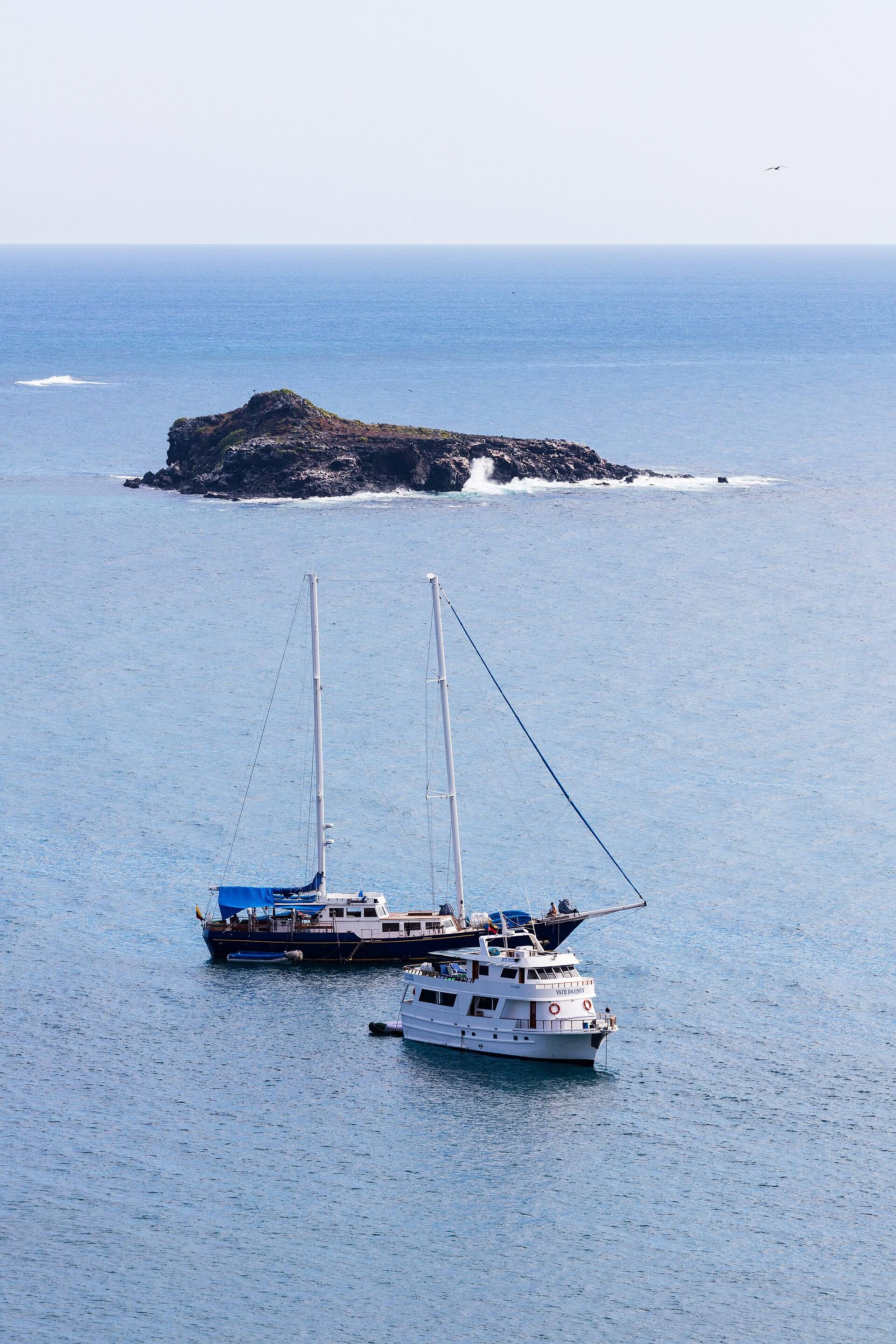
An islet off Punta Pitt seen from the sea.
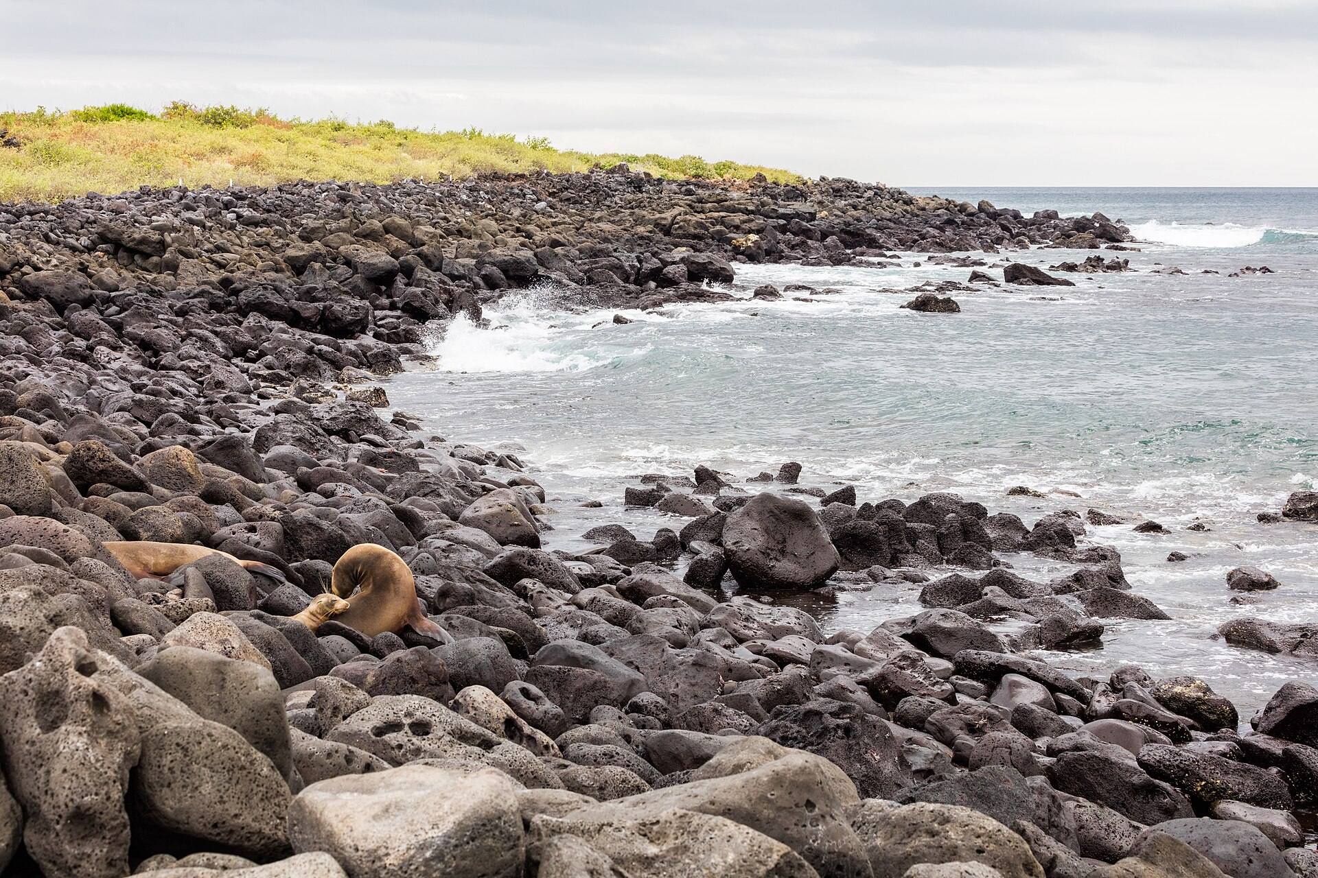
Rocky coastal landscape and vegetation on Isla Lobos.
Sources & last checked
Checked 20 October 2026. Prices, access and transport can change; confirm with the linked official source before travelling.
Plan your trip
Compare tours
Check current dates, inclusions and availability on GetYourGuide.
We may earn a commission on bookings through these links. How this works.